JULIE can receive and process several different types of requests, including the following.

Normal


A Normal Locate Request is the most common type of request and requires at least 2 days (12 a.m. to 11:59 p.m.) notice, excluding weekends, JULIE recognized holidays and the day of the notice. JULIE limits the extent of a locate request to ¼ contiguous mile within a municipality and one (1) contiguous mile within any unincorporated area, which includes townships.

Emergency


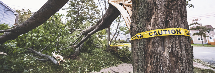
An Emergency Locate Request is defined in the Act as a locate request for any condition constituting an imminent danger to life, health or property, or a utility service outage, and which requires repair or action within 2 days and has an expiration of 10 days. Examples include, but are not limited to:

  1. An unforeseen excavation necessary in order to prevent a condition that poses a clear and imminent danger to life or health
  2. An excavation required to repair a utility service outage
  3. An immediate excavation required in order to prevent significant property or environmental danger

The reinstallation of traffic control devices and an open cut utility locate shall be deemed an emergency according to Section 6 of the Act.

Guidelines for making an Emergency Locate Request

When calling JULIE at 811 or (800) 892-0123, callers are prompted to press “5” for an emergency locate request. Callers must inform the call center agent that an emergency exists and be prepared to explain the situation and/or conditions. The agent will prepare an emergency locate request and note the planned start date and time. The caller must provide a phone number that will be answered by someone who can further explain the situation.

There is a wait time of 2 hours or the date and time requested on the notice, whichever is longer. If the conditions at the site dictate an earlier start time than the required wait time, it is the responsibility of the excavator to dig carefully, and be able to demonstrate that site conditions warranted this earlier start time.

If a facility owner(s) does not respond through the positive response system within the required time, call JULIE and indicate which facility owner(s) has not responded. JULIE will send another request to the appropriate facility owner(s). Be specific when reporting which company failed to respond.

JULIE assumes that all callers provide accurate information regarding emergency situations. Work scheduling issues and/or lack of timely notification on the excavator’s part for a normal locate request do not constitute emergency situations. Penalties may be assessed by the Illinois Commerce Commission, One-Call Enforcement Division for false emergencies.

Damage


A Damage Request is initiated by an excavator through JULIE to inform underground utility facility owners or operators that damage to a facility has occurred in the area of the excavation or demolition.

Exposed


An Exposed Request is initiated by an excavator through JULIE to inform underground utility facility owners or operators that an unmarked facility has been exposed in the area of the excavation or demolition but has not been damaged.

Extension


An Extension Request is initiated by an excavator through JULIE to inform underground utility facility owners or operators to extend the expiration date of a normal notice to allow additional time to continue or complete the excavation or demolition project.

  1. An Extension Request may be made no earlier than the 20th day from the initial normal notice request or latest extension request.
  2. An Extension Request shall extend the expiration of the initial normal notice request or latest extension request by 25 days.
  3. An Extension Request may not be made simply to keep a prior notice open without continued excavation occurring within the period of that subsequent notice.

No Show


A No Show Request is initiated by an excavator through JULIE to inform underground utility facility owners or operators notified in a prior locate request who either failed to mark their facilities or communicate their non-involvement through the positive response system prior to the requested dig start date and time. It is important to be specific about which company failed to respond.

Incomplete


An Incomplete Request is initiated by an excavator through JULIE to inform underground utility facility owners or operators notified in a prior locate request that such facility owners or operators, as identified by the excavator, did not completely mark the entire extent or the entire segment of the proposed excavation as identified by the excavator in the prior notice. Please be specific on which company failed to complete their marking.

Re-mark


A Re-mark Request is initiated by an excavator through JULIE to request underground utility facility owners or operators notified in the initial locate request to re-mark the area of the original extent where excavation is to continue because facility markings are becoming or have become indistinguishable due to factors including, but not limited to, weather, fading, construction activity, or vandalism. Depending on the circumstances, some or all of the previously notified companies will be required to re-mark within 2 days after the day of receiving the Re-Mark Request notice.

Joint Meet


A Joint Meet is a meeting to exchange information such as maps, plans or schedules, and to openly discuss the project and work together with the JULIE members and their locators. It is not a locating session. After the Joint Meet, excavators will be required to contact JULIE for locate requests in order to have underground utility facilities marked. Large non-emergency projects may require multiple locating sessions to mark all affected facilities.

Required information for a Joint Meet

To request a Joint Meet, the following information must be given to the JULIE call center agent or the request will be suspended:

  1. The excavator’s name, address, phone number at which the excavator can be reached, a fax number (if available), and email address
  2. The county and place or places where the work will be performed;
  3. Street names involved in the project or the north, south, east, and west boundaries of the project, or the section number or numbers involved in the project;
  4. The date, time and location where the Joint Meet will take place, which shall be near the project site; and
  5. A minimum advance notice of the Joint Meet of 2 days (5 days for large projects), but no more than 60 days, prior to the planned start of excavation or demolition.

Planning/Design Request


Section A: An underground utility facility owner or operator shall have the following responsibilities:

  1. Respond to a valid planning design request within 10 days after receiving the request or by such other date as shall be mutually agreed upon between the underground utility facility owner or operator and the designer or planner. The underground utility facility owner or operator shall provide information regarding the location, size, if greater than 1.5 inches in diameter, which shall be generically listed as communication, electric, gas, water, sewer, streetlight, or traffic control and if direct buried or in conduit or a duct package, of facilities based on the best information available to the underground utility facility owner or operator within the scope of the proposed project;
  2. Respond to a planning design request in one of the following methods:
      • A. Provide the most current digital, KMZ file or shapefile, or paper drawings or prints, that are drawn to scale, when available, and include visible utility structures, including measurements from back of curb, sidewalk, edge of pavement, centerline of ditch, property lines, and other similar items;
      • B. Request the proposed plans or drawings from the designer or planner and illustrate the location of the underground utility facility owner’s or operator’s facilities, drawn to scale, and, if available, provide the type and size, as described in paragraph (1), of the facilities, including visible structures on the plans;
      • C. Locate and mark the underground utility facility owner’s or operator’s facilities within the scope of the proposed project, as agreed to with the planner or designer;
      • D. If the responding underground utility facility owner or operator is unable to comply with paragraph (A) or (B), then the underground utility facility owner or operator shall mark the facilities within the scope of the proposed project, as agreed to with the planner or designer; or
      • E. If marking of infrastructure is the preferred or required response of the underground utility facility owner or operator, the underground utility facility owner or operator need only mark main line facilities or any service lines that would otherwise be considered main line due to size or type, as described in paragraph (1).
  3. May charge a nominal fee to locate and mark the proposed project, as described in subparagraph (C) or (D) of paragraph (2).

Section B: The planner or designer shall have the following responsibilities:

  1. Follow the guidelines set forth in CI/ASCE 38-02 Standard Guidelines for the Collection and Depiction of Existing Subsurface Utility Data, as from time to time amended, when preparing plans or drawings;
  2. Illustrate on all appropriate documents the position, size and type, as described in paragraph (1) of subsection (A), of all known facilities obtained in the planning design request process and include the valid planning design request number provided by JULIE on any plans or drawings; and
  3. Make all reasonable efforts to prepare the plans or drawings to minimize interference with known existing and proposed facilities in the proposed project area.

Section C: A Planning/Design Request shall include the following information:

  1. Name, address, telephone number, office and cell phone, and, if available, email address of the designated contact requesting the information;
  2. Name, address, telephone number, office and cell phone, and, if available, email address of the project owner;
  3. The approximate date when the facility information is required; and
  4. The specific area requiring facility information by one or more of the following means:
    • A. The county and place or places involved in the proposed project;
    • B. Street names involved in the proposed project or the north, south, east, and west boundaries of the proposed project, or the section number or numbers involved in the proposed project;
    • C. Latitude and longitude coordinates of the outside edges of the proposed project;
    • D. Digital data such as, but not limited to, shapefiles when technology and software allow; and
    • E. The type of work projected to take place within the proposed project.


Back
Translate »